Over the years I have seen numerous online Map apps for all kinds of outdoor uses. We see apps that focus on hunting, biking, hiking, off-roading and so on. The majority of these app’s offer real-time gps usage using a smart phone. Most take advantage to a phone on board gps rather than cell service. The use or need of an independent gps device is waning.
The majority of these apps charge for the app either by a one-time purchase or a subscription. Many are good, many are pretty much affordable. I like free.
In addition, a person can create their own maps with the tons of software out there or even go to certain sites and create some sort of map on their website (example: https://www.fs.usda.gov/ivm/ ) and download to your device however there is still the need to view the map on some sort of app that utilizes real-time gps, which really, to my knowledge is currently limited to one app at this time. However, some of these maps can be viewed on adobe or other picture viewing apps depending what format they are saved in. Unfortunately, these viewers do not offer real-time gps but nonetheless you can store and view maps.
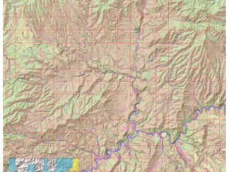
Again, there is a ton of free maps out there. Just about any USGS topo quad map can be downloaded free. The currently, free, Avenza Maps app (Formerly PDF Maps) will display a majority of these maps with real-time gps. The downside is that a person may need a number of these quad maps depending upon the area of interest.
So, let me throw out some “What If’s”. What if the current app you use goes belly up and for some reason and no longer operates on your phone or you miss a subscription payment or whatever…. Can you still view your maps? What if gps quicks working for some reason? Can you still bring your map up to at least view it and possibly utilize old school mapping techniques? Should you invest in paper maps of your important areas just in case? Maybe, but that could be cumbersome. The beauty of the smart phone is you can store a ton of data and also backup that data.
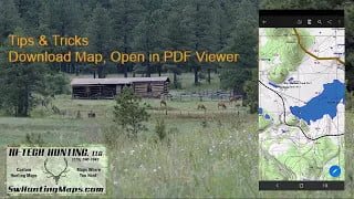
What I do: I have hundreds of maps on my phone. The majority I store on my SD card for ease of transfer in case I break or upgrade my phone. Yes, the new phone would need to have a SD card slot, which is becoming more and more rare. Maybe the work around is keeping an old phone with a SD card slot exclusively for your mapping, rather than trading it in on an upgrade. There are many options however back to my point. Ok, my app quit working, I’m out in the boonies, and need to see where I think I am at. I know the map was saved as a pdf document so I navigate to where my map is stored and open it using any pdf viewer. Yea, it won’t have real-time gps but using mapping fundamentals and the compass on your phone or in your pocket I should be able determine where I am at and navigate to where I want to go. Including the Avenza Map app ( https://store.avenza.com/ ), most maps downloaded for use in the app does not offer an alternative way to view the map outside of the app. All the maps I create and display on my website (http://hitechhuntingllc.com/ ) can be viewed in either the Avenza Map app or any pdf viewer. Maps stored on the Avenza Map store only work with their app. One more thing…transfer one of these pdf maps to your pc and open it in PC version of Adobe. You can do a number of things like turning on and off certain layers, edit and set up to print!
For more information on how you can start your own collection and be prepared for the “What If’s” contact me at HiTechHunting@gmail.com and visit me on my website at: ( http://hitechhuntingllc.com/about-us/ )